Later this year, Google’s map service will receive a far-reaching update that includes the Google Maps Immersive View function. In combination with satellite and Street View images, maps can be displayed in almost photorealistic quality via 3D mapping.
Google Maps Immersive View looks impressive
Google had already announced some time ago that it wanted to combine the satellite images and Street View shots of the Google Maps mapping platform. The result is called Immersive View, and it looks impressive thanks to the platform’s advanced 3D mapping and machine learning.
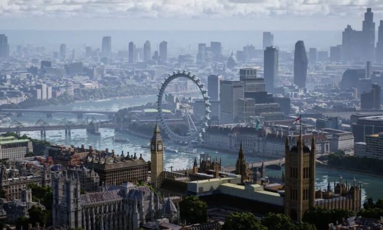
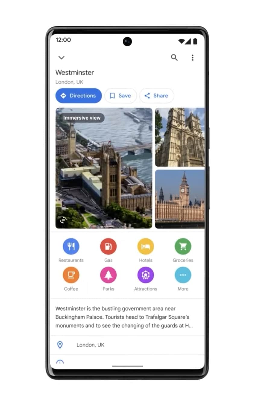
Google has demonstrated the new feature using the example of England’s capital London, where Google Maps zooms directly into the 3D map of the city from the perspective of a virtually approaching drone, showing sights such as Westminster Abbey or the London Eye in almost photo-realistic graphics.
But that’s not all. The new Google Maps Immersive View also displays other details in real time, such as the current traffic situation and the weather. A weather forecast is also offered via a timeline at the bottom of the screen, which provides an outlook on developments in the following hours. The sky in the Maps view adapts to the forecast accordingly and also displays rain showers, for example – which is of course particularly important for London and England.
Virtually move through buildings
No less impressive is the option of Google Maps Immersive View, which lets you virtually fly from the street into buildings. From the Street View, for example, you can simply enter a restaurant (shown using the Cinnamon Club as an example) and get an overview of the tables or find your way to the restroom.
The feature almost borders on magic. Google’s CEO Sundar Pichai introduced Immersive View at the Google I/O 2022 keynote, revealing that this virtual visit to a building is generated solely by neural rendering from photos provided by the locations themselves or visitors.
The immersive view of Google Maps will be made available on all smartphones and similar devices as soon as it is available. The function will initially be launched in the course of the year for selected cities such as Los Angeles, London, New York, San Francisco and Tokyo. However, other locations are to follow.


No replies yet
Neue Antworten laden...
Gehört zum Inventar
Beteilige dich an der Diskussion in der Basic Tutorials Community →